Home → Fish & Wildlife → Wildlife → Endangered & Threatened Species → Essential Habitat Maps
Essential Habitat Maps
All Essential Habitats are mapped on satellite imagery and are indexed by map grid below. Official maps are filed at the Secretary of State's office, and copies of official maps are available from all MDIFW and affected town offices. Advisory maps can be viewed and printed by clicking on grid areas designated on the following map.
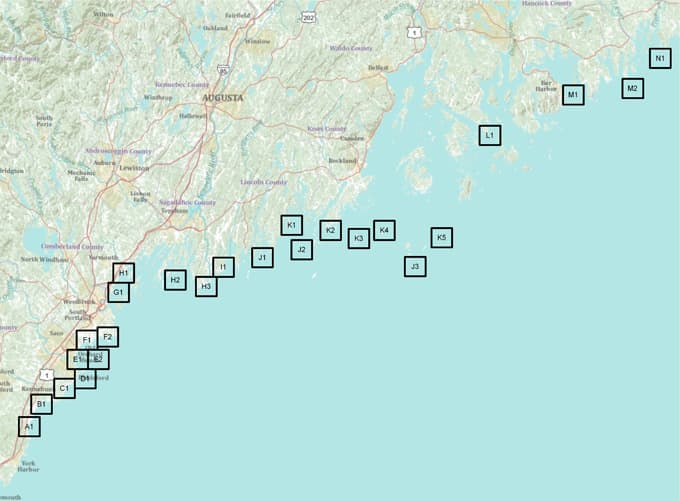
Map A1 | Map B1 | Map C1 | Map D1 | Map E1 | Map E2 | Map F1 | Map F2 | Map G1 | Map H1 | Map H2 | Map H3 | Map I1 | Map J1 | Map J2 | Map J3 | Map K1 | Map K2 | Map K3 | Map K4 | Map K5 | Map L1 | Map M1 | Map M2 | Map N1