Home → Fishing & Boating → Fishing → Fishing Resources → Maine Fishing Guide → Places to Fish → Region D - Rangeley Lakes Region
Region D - Rangeley Lakes Region
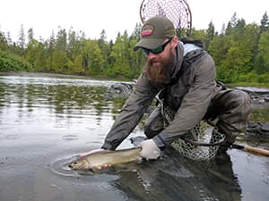
Nestled among Maine's highest mountains, featuring pristine waters teaming with wild trout and salmon, Maine's Rangeley Lakes Region has long been a destination for anglers that have included everyone from Presidents to everyday families. The Rangeley Lakes Region's rich outdoor angling history includes Maine's first ever guide – Fly Rod Crosby, its own boat design – the Rangeley Laker, and history of famous flies such as the Gray Ghost, Colonel Bates, and Parmachenee Belle. Come and create your own history fishing for a variety of fish in unmatched wilderness settings or quaint new England villages, the Rangeley Lakes Region has it all if you love the outdoors.
— Liz Latti, Fisheries Resource Supervisor
Special fishing laws may apply to these water bodies. Always check the current Maine Open Water & Ice Fishing Laws first!
Species Key
Primary Fishery Species
 Rainbow Trout (RBT)
 Lake Whitefish (LWF)
 Arctic Charr (CHR)
Status
- Stocked ... (S)
- Wild ... (W)
- Mixture of Stocked & Wild ... (S&W)
Towns
Alder Stream
Andover
Anson
Athens
Avon
Bald Mountain
Bethel
Bigelow
Bingham
Bowmantown
Bowtown
Brighton
Byron
Canton
Caratunk
Carrabasset Valley
Carrying Place
Carthage
Chain of Ponds
Chase Stream
Chesterville
Coburn Gore
Concord
Coplin Plt.
Cornivlle
Dallas Plt.
Dead River
Dixfield
East Moxie
Embden
Eustis
Farmington
Flagstaff
Freeman
Grafton
Hanover
Highland Plt.
Indian Stream
Industry
Jay
Jim Pond
Kibby
King and Bartlett
Kingfield
Lang
Lexington
Lincoln
Lower Cupsuptic
Lower Enchanted
Lynchtown
Madison
Madrid
Massachusetts
Gore
Mayfield
Mercer
Mexico
Milton
Moscow
Mount Abram
Moxie Gore
New Portland
New Sharon
New Vineyard
Newry
Norridgewock
Parkertown
Parmachenee
Perkins
Peru
Phillips
Pierce Pond
Pleasant Ridge Plt.
Rangeley
Rangeley Plt.
Redington
Richardstown
Riley
Rumford
Salem
Sandy River Plt.
Seven Ponds
Skowhegan
Solon
Squaretown
Starks
Stetsontown
Strong
T3 R4 BKP WLR
T3 R5 BKP WLR
Temple
The Forks
Tim Pond
Township 6
Township C
Township D
Township E
Upper Cupsuptic
Upton
Weld
West Forks
Wilton
Wyman
Brook Trout Fishing
Beaver Pond Twp D, Franklin County
Max Depth: 19 feet, Area: 20 acres
Primary Fishery: BKT (S)
Access: Carry in access on Rte 17.
Notes: Unimproved launch.
Delorme Atlas: Map 18 section B-4
Big Dimmick Pond Caratunk, Somerset County
Max Depth: 39 feet, Area: 90 acres
Primary Fishery: BKT (S&W)
Access: Carry in access on Baker Dimmick Rd off Trout Dale Rd.
Notes: No developed launch.
Delorme Atlas: Map 30 section B-4
Chain of Ponds Chain of Ponds, Franklin County
Max Depth: 106 feet, Area: 700 acres
Primary Fishery: BKT (S&W), LLS (W)
Access: Trailered boat access on Rte 27.
Notes: Improved launches, mostly from campsites.
Delorme Atlas: Map 38 section E-4
Little Austin Pond Bald Mtn Twp, Somerset County
Max Depth: 33 feet, Area: 110 acres
Primary Fishery: BKT (S&W)
Access: Carry in access via gravel road off Austin Pond Road.
Notes: Unimproved launch.
Delorme Atlas: Map 30 section B-5
Little Jim Pond Jim Pond Twp, Franklin County
Max Depth: 37 feet, Area: 64 acres
Primary Fishery: BKT (S)
Access: Carry in access off King & Bartlett Rd.
Notes: Unimproved launch.
Delorme Atlas: Map 29 section A-2
Quimby Pond Rangeley, Franklin County
Max Depth: 12 feet, Area: 165 acres
Primary Fishery: BKT (S&W)
Access: Carry in access on Quimby Pond Rd.
Notes: Unimproved launch.
Delorme Atlas: Map 28 section E-4
Round Pond Township E, Franklin County
Max Depth: 8 feet, Area: 42 acres
Primary Fishery: BKT (S)
Access: Carry in access on D Town Rd.
Notes: Unimproved launch
Delorme Atlas: Map 18 A-4/B-4
Sandy River Ponds Sandy River Plt, Franklin County
Max Depth: 58 feet, Area: 115 acres
Primary Fishery: BKT (S&W)
Access: Carry in access on Rte 4.
Notes: Unimproved launch.
Delorme Atlas: Map 19 section A-1
Shiloh Pond Kingfield, Franklin County
Max Depth: 39 feet, Area: 19 acres
Primary Fishery: BKT (S&W)
Access: Carry in access on Tufts Pond Rd.
Notes: Unimproved launch
Delorme Atlas: Map 29 section D-5
West Richardson Pond Adamstown Twp, Oxford County
Max Depth: 41 feet, Area: 423 acres
Primary Fishery: BKT (S&W), LLS (W)
Access: Carry in access on West Richardson Rd off Rte 16.
Notes: Unimproved launch.
Delorme Atlas: Map 28 section E-1 & 2
Landlocked Salmon Fishing
Aziscohos Lake Lincoln Plt, Oxford County
Max Depth: 60 feet, Area: 6,700 acres
Primary Fishery: LLS (W), BKT (W)
Access: Trailered boat access on Camp 10 Bridge Rd and Lincoln Pond Rd at campground.
Notes: Improved launch. Trailered boat access.
Delorme Atlas: Map 28 section C-1 & E-2
Chain of Ponds Chain of Ponds, Franklin County
Max Depth: 106 feet, Area: 700 acres
Primary Fishery: BKT (S&W), LLS (W)
Access: Trailered boat access on Rte 27.
Notes: Improved launches, mostly from campsites.
Delorme Atlas: Map 38 section E-4
Clearwater Pond Industry, Franklin County
Max Depth: 129 feet, Area: 751 acres
Primary Fishery: BKT (S&W), LLS (S), LKT (W)
Access: Trailered boat access off Route 43.
Notes: Improved Launch.
Delorme Atlas: Map 20 section C -2
Jim Pond Jim Pond Twp, Franklin County
Max Depth: 125 feet, Area: 320 acres
Primary Fishery: LLS (W), LKT (W), BKT (S&W)
Access: Trailered boat access off Jim Pond Rd.
Notes: Improved launch.
Delorme Atlas: Map 29 section A-1
Loon Lake Dallas Plt, Franklin County
Max Depth: 57 feet, Area: 176 acres
Primary Fishery: LLS (S&W), BKT (S&W)
Access: Carry in access off Loon Lake Rd.
Notes: Unimproved launch.
Delorme Atlas: Map 28 section D-5
Mooselookmeguntic Lake Rangeley, Franklin County
Max Depth: 139 feet, Area: 16,300 acres
Primary Fishery: LLS (W), BKT (W)
Access: Trailered boat access off Rte 16 at Haines Landing, or on South Arm Rd.
Notes: Improved launches.
Delorme Atlas: Map 28 section E-3 and Map 18 section A-3
Porter Lake New Vineyard, Franklin County
Max Depth: 86 feet, Area: 527 acres
Primary Fishery: LLS (S), LKT (W), BKT (S)
Access: Trailered boat access off Beanies Beach Road.
Notes: Improved launch.
Delorme Atlas: Map 20 section B -1
Rangeley Lake Rangeley, Franklin County
Max Depth: 149 feet, Area: 6,000 acres
Primary Fishery: LLS (S&W), BKT (S&W)
Access: Trailered boat access in Rangeley Lake State Park, Rangeley Town park, and on Rte4
Notes: Improved launches.
Delorme Atlas: Map 28 section E-3, 4 & 5
Richardson Lakes Richardsontown Twp, Oxford County
Max Depth: 108 feet, Area: 5,100 acres
Primary Fishery: LLS (S&W), BKT (S&W), LKT (W)
Access: Trailered boat access on South Arm
Rd and Mill Brook Rd.
Notes: Improved launches.
Delorme Atlas: Map 18 section A & B-2
Spencer Lake Hobbstown, Somerset County
Max Depth: 135 feet, Area: 1,819 acres
Primary Fishery: LLS (S), LKT (W), BKT (W)
Access: Trailered boat access via launch on Fish Pond on gravel road off Spencer Rd. Boat down to Spencer Lake.
Notes: Improved launch.
Delorme Atlas: Map 39 section D & E-4
Varnum Pond Temple, Franklin County
Max Depth: 75 feet, Area: 370 acres
Primary Fishery: LLS (S), LKT (W). BKT (S)
Access: Trailered boat access off of Varnum Pond Rd.
Notes: Improved launch.
Delorme Atlas: Map 19 section D-5
Brown Trout/Splake Fishing
Lufkin Pond Phillips, Franklin County
Max Depth: 28 feet, Area: 47 acres
Primary Fishery: BNT (S), SPK (S), SMB
Access: Carry in access off Number 6 Rd.
Notes: No developed launch.
Delorme Atlas: Map 19 section A-2
Mount Blue Pond Avon, Franklin County
Max Depth: 38 feet, Area: 134 acres
Primary Fishery: BNT (S), SPK (S)
Access: Carry in access off Mount Blue Rd.
Notes: No developed launch.
Delorme Atlas: Map 19 section B-3 & 4
Sandy Pond Embden, Somerset County
Max Depth: 41 feet, Area: 107 acres
Primary Fishery: BNT (S), BKT (S)
Access: Carry in access from Fahi Pond Rd.
Notes: Hand carry launch.
Delorme Atlas: Map 20 section A-3
Smith Pond Brighton Plt, Somerset County
Max Depth: 32 feet, Area: 160 acres
Primary Fishery: BNT (S), BKT (S)
Access: Trailered boat access via gravel road off Rte 151.
Notes: Unimproved launch.
Delorme Atlas: Map 31 section D-1
Webb Lake Weld, Franklin County
Max Depth: 42 feet, Area: 2,146 acres
Primary Fishery: BNT (S), BKT (S), LLS (S)
Access: Trailered boat access from Mt. Blue State Park.
Notes: Improved launch.
Delorme Atlas: Map 19 section C-2
Wentworth Pond Solon, Somerset County
Max Depth: 48 feet, Area: 213 acres
Primary Fishery: BNT (S), BKT (S), SPK (S)
Access: Carry in access on West Shore Road.
Notes: Unimproved launch.
Delorme Atlas: Map 31 section E-1
Wesserunsett Lake Madison, Somerset County
Max Depth: 22 feet, Area: 1,446 acres
Primary Fishery: BNT (S), BKT (S)
Access: Trailered boat access off E. Madison Rd.
Notes: Improved launch.
Delorme Atlas: Map 20 section A & B-5
Back to top
Togue (Lake Trout) Fishing
Clearwater Pond Industry, Franklin County
Max Depth: 129 feet, Area: 751 acres
Primary Fishery: LKT (W), BKT (S&W), LLS (S)
Access: Trailered boat access on Rte 43.
Notes: Improved launch.
Delorme Atlas: Map 20 section C-1 & 2
Embden Pond Embden, Somerset County
Max Depth: 180 feet, Area: 1,568 acres
Primary Fishery: LKT (W), LLS (S&W), BKT (S)
Access: Trailered boat access on Mill Rd off Embden Pond Rd.
Notes: Improved launch.
Delorme Atlas: Map 20 section A -3 & map 30 section E-3
Jim Pond Jim Pond Twp, Franklin County
Max Depth: 125 feet, Area: 320 acres
Primary Fishery: LLS (W), LKT (W), BKT (S&W)
Access: Trailered boat access off Jim Pond Rd.
Notes: Improved launch.
Delorme Atlas: Map 29 section A-1
Lincoln Pond Parkertown Twp, Oxford County
Max Depth: 95 feet, Area: 340 acres
Primary Fishery: LKT (W), BKT (S)
Access: Carry in access on Big Buck Mtn Rd off Alca Rd.
Notes: 4WD vehicles only.
Delorme Atlas: Map 28 section D-1
Porter Lake New Vineyard, Franklin County
Max Depth: 86 feet, Area: 527 acres
Primary Fishery: LLS (S), LKT (W), BKT (S)
Access: Trailered boat access off Beanies Beach Rd.
Notes: Improved launch.
Delorme Atlas: Map 20 section B -1
Richardson Lakes Richardsontown Twp, Oxford County
Max Depth: 108 feet, Area: 5,100 acres
Primary Fishery: LLS (S&W), BKT (S&W), LKT (W)
Access: Trailered boat access on South Arm
Rd and Mill Brook Rd.
Notes: Improved launches.
Delorme Atlas: Map 18 section A & B-2
Spencer Lake Hobbstown, Somerset County
Max Depth: 135 feet, Area: 1,819 acres
Primary Fishery: LLS (S), LKT (W), BKT (W)
Access: Trailered boat access via launch on Fish Pond on gravel road off Spencer Rd. Boat down to Spencer Lake.
Notes: Improved launch.
Delorme Atlas: Map 39 section D & E-4
Spring Lake T3 R4 BKP WKR, Somerset County
Max Depth: 78 feet, Area: 762 acres
Primary Fishery: LKT (W), BKT (S), LLS (S)
Access: Trailered boat access on Spring Lake Rd
Notes: Improved launch.
Delorme Atlas: Map 29 section B-4
Varnum Pond Temple, Franklin County
Max Depth: 75 feet, Area: 370 acres
Primary Fishery: LLS (S), LKT (W). BKT (S)
Access: Trailered boat access off of Varnum Pond Rd.
Notes: Improved launch.
Delorme Atlas: Map 19 section D-5
Wilson Pond Wilton, Franklin County
Max Depth: 88 feet, Area: 563 acres
Primary Fishery: LKT (W), LLS (S&W), BKT (S&W)
Access: Trailered boat access off Pond Rd and carry in access on Rte 2.
Notes: Improved launch at Canal Street off Rte. 2.
Unimproved launch off Pond Rd.
Delorme Atlas: Map 19 section D-4 & 5
Back to top
Rivers / Streams / Brooks
Alder Brook Perkins Twp., Franklin County
Primary Fishery: BKT (W)
Access: Walk in access on Alder Brook Rd.
Delorme Atlas: Map 19 section C-3 & 4
Austin Stream Bingham, Somerset County
Primary Fishery: BKT (W), RBT (W)
Access: Walk in access.
Delorme Atlas: Map 30 section C-4
Carrabassett River Anson, Somerset County (Carrabassett Valley to Anson)
Primary Fishery: RBT (S), BKT (S&W)
Access: Walk in access off Rte 27 and Rte 146.
Notes: Parts (Kingfield) are Youth Only fishing.
Delorme Atlas: Map 20 section A-3
Dead River The Forks Plt, Somerset County (From T03 R04 BKP WKR to The Forks Plt.)
Primary Fishery: BKT (S&W), LLS (S&W)
Access: Walk in access.
Delorme Atlas: Map 40 section E-2
Kennebago River Rangeley, Franklin County (Stetsontown Twp to Rangeley)
Primary Fishery: BKT (W), LLS (W)
Access: Walk in access. Carry in access on Boy Scout Rd.
Delorme Atlas: Map 28 section D-3
Magalloway River Lincoln Plt, Oxford County (Lincoln Plt to Magalloway Plt)
Primary Fishery: BKT (W), LLS (W)
Access: Walk in access off Rt. 16 & Bennett Rd.
Delorme Atlas: Map 27 section E -5
Orbeton Stream Madrid, Franklin County
Primary Fishery: BNT (W), BKT (W)
Access: Walk in access.
Delorme Atlas: Map 19 section A-2 & 3.
Phelps Brook Byron, Oxford County
Primary Fishery: BKT (W)
Access: Walk in access off Garland Pond Rd.
Delorme Atlas: Map 18 section C-4
Rapid River Upton, Oxford County
Primary Fishery: BKT (W), LLS (W)
Access: Walk in access.
Delorme Atlas: Map 18 section B-1
Sandy River Farmington, Franklin County (Sandy River Plt to Norridgewock)
Primary Fishery: BKT (S&W), BNT (S)
Access: Walk in access.
Delorme Atlas: Map 19 section B-4 & 5
Swift River Byron, Oxford County (Byron to Rumford)
Primary Fishery: RBT (S), BNT (S), BKT (S&W)
Access: Walk in access.
Delorme Atlas: Map 18 section C & D-5
Wilson Stream Wilton, Franklin County
Primary Fishery: BKT (S&W)
Access: Main St.
Delorme Atlas: Map 19 section D-4 & 5