Home → Water Quality → Monitoring → Coastal
Monitoring and Assessment of Estuarine and Marine Waters
Contacts
Angela Brewer (Marine Unit Leader) 207-592-2352
James Stahlnecker (Toxics) 207-215-6954
Cheyenne Adams (Vegetation Mapping) 207-352-8508
Emily Zimmermann (Salmon Habitat) 207-446-1003
John Fisher (Vegetation Mapping Technician) 207-816-1813
Estuarine and Marine Waters Contacts and Related Resources
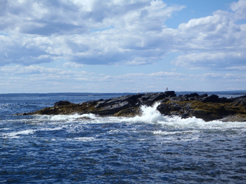
The Marine Unit monitors and assesses the health of marine waters (estuarine and coastal areas) through the collection of physical, chemical, and biological samples as related to attainment of Maine's water quality standards (38 M.R.S. § 465-B). For further information, see Maine's water classifications and Class SA marine waters.
The Marine Unit provides technical support to the DEP's Maine Pollutant Discharge Elimination System (MEPDES) program for wastewater discharges, as well as for Natural Resources Protection Act (NRPA) permits for coastal development projects. The Marine Unit supports volunteer water quality monitoring and other non-governmental organizations working within Maine's marine waters that engage in protection, maintenance and restoration of water and habitats (selected partner's websites are listed below).
Marine Environmental Monitoring Program (MEMP)
 Maine's MEMP was established in 1991 (38 M.R.S. § 410-F) to monitor the "extent and effect of industrial contaminants and pollutants on marine and estuarine ecosystems and to determine compliance with and attainment of water quality standards". Monitoring efforts are focused on ambient water quality, nutrients, and eutrophication indicators, in particular near wastewater discharges.
Eelgrass (Zostera marina) is a sensitive indicator of excess nitrogen in coastal waters, and has been the subject of aerial mapping and SCUBA-based monitoring efforts, especially in Casco Bay. These efforts, the values of eelgrass and how it can be protected are outlined in this fact sheet. (pdf)
Reports on Casco Bay eelgrass distribution and percent cover changes:
- Casco Bay (Cape Elizabeth to Phippsburg) Seagrass Mapping (2022) (pdf)
- Southern Maine (Eliot to Cape Elizabeth) Seagrass Mapping (2021) (pdf)
- Casco Bay (Cape Elizabeth to Phippsburg) Seagrass Mapping (2018) (pdf)
- Casco Bay (Cape Elizabeth to Phippsburg) Seagrass Mapping (2013) (pdf)
All mapped seagrass and low tide aerial imagery can be visualized through the Maine GeoLibrary. As of 2023, the Marine Vegetation Mapping Program (MVMP) (see below) annually surveys 1/5 of Maine’s seagrass and salt marsh resource.
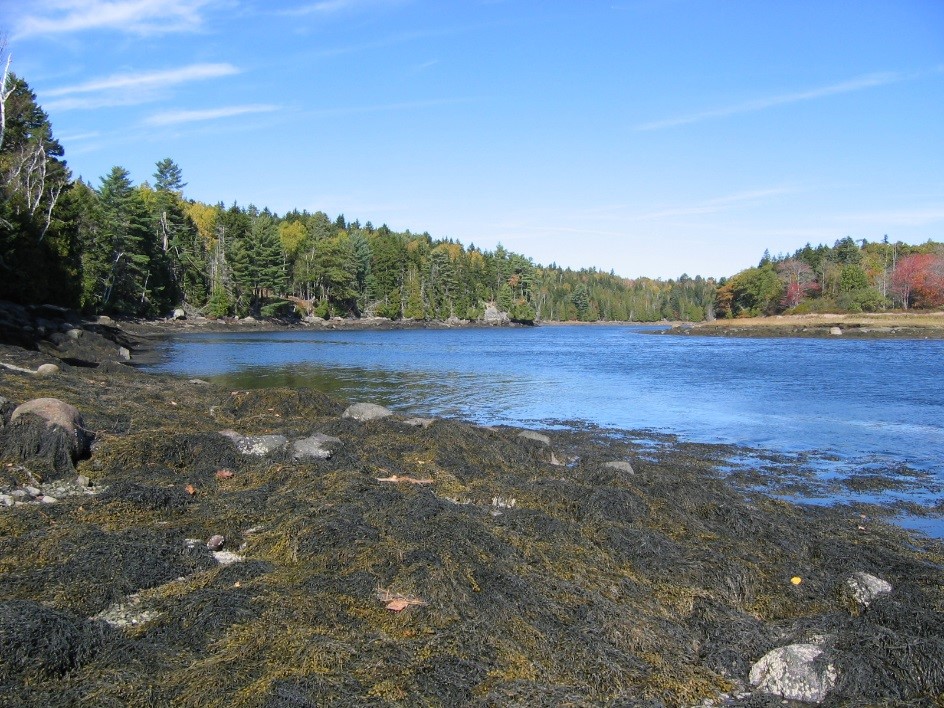
Marine Vegetation Mapping Program (MVMP)
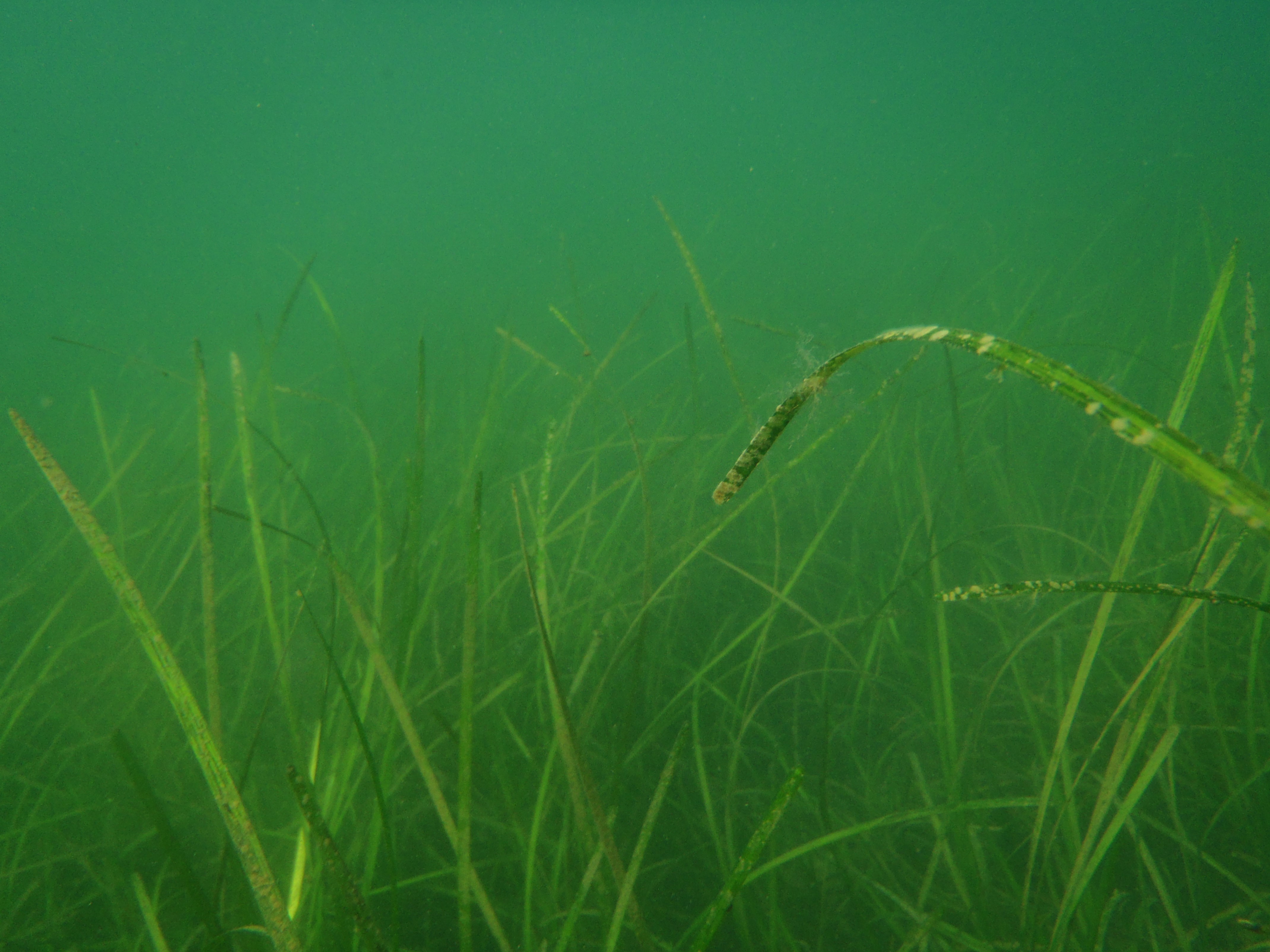 Maine’s Marine Vegetation Mapping Program (MVMP) was established in 2023 (38 M.R.S. §1805) to survey and delineate the coastwide distribution of seagrass and tidal marsh habitat. Mapping is conducted on a 5-year regional rotation (pdf) starting in the Midcoast Region in 2023 and moving to the Penobscot Bay Region in 2024, the Acadia Region in 2025, the Downeast Region in 2026, the Southern Region in 2027, and then continuing in accordance with the same schedule. The seagrass meadows in Maine are predominantly eelgrass (Zostera marina) and occupy the shallow subtidal and protected lower intertidal locations. Tidal marsh vegetation includes cordgrasses (Spartina alterniflora and S. patens), graminoids, and forbs. Coastal vegetation provides critical habitat, nursery grounds, storm surge protection, carbon sequestration, and water quality benefits to the nearshore environment, and requires routine mapping to detect changes in extent and condition. The Department of Marine Resources previously mapped coastwide eelgrass distribution and percent cover in 1993-1997 and in 2001-2010 and DEP’s Marine Environmental Monitoring Program previously mapped seagrass, including eelgrass, in Southern Maine and Casco Bay in 2013-2022 (see above). The Department of Conservation, Agriculture and Forestry’s Maine Natural Areas Program previously digitized coastwide tidal marsh distribution and community type in 2021 based on the best available aerial imagery. All MVMP seagrass and tidal marsh distribution maps and aerial imagery will be available through the Maine GeoLibrary as they are produced, and are linked below.
- Legislative Report: Penobscot Bay and Acadia Maine (Port Clyde to Jonesport) Seagrass and Tidal Marsh Mapping (2024-2025) (pdf)
- Legislative Report: Midcoast Maine (Phippsburg to Port Clyde) Seagrass and Tidal Marsh Mapping (2023) (pdf)
- Maine DEP Acadia Seagrass 2025 (feature service layer)
- Maine Orthoimagery Coastal Acadia 2025 (imagery service layer)
- Maine DEP Penobscot Bay Seagrass 2024 (feature service layer)
- Maine Orthoimagery Coastal Penobscot Bay 2024 (imagery service layer)
- Maine DEP Mid-Coast Seagrass 2023 (feature service layer)
- Maine Orthoimagery Coastal Midcoast 2023 (imagery service layer)
Salmon Habitat Monitoring Program
The salmon program monitors water quality and biological communities in Maine's Atlantic salmon rivers and streams in close collaboration with state and federal agencies and non-profit groups, with the goal to restore and enhance the endangered populations of this species.
Surface Water Ambient Toxics (SWAT) Program
 Maine's SWAT monitoring program was established in 1993 (34 M.R.S. § 420-B) to determine the nature, scope and severity of toxic contamination in the surface waters and fisheries of the State. The Marine Unit monitors for the presence of toxic contaminants in tissues from softshell clams (Mya arenaria), blue mussels (Mytilus edulis), and lobster (Homarus americanus), among other species.
The Marine Unit has collaborated with other toxics monitoring programs including the former Gulfwatch program, which was administered by the Gulf of Maine Council on the Marine Environment (GOMC), and Mussel Watch, a National Oceanic and Atmospheric Administration (NOAA) program.
Reporting
Marine water quality standards assessments are documented biennially in Integrated Water Quality Monitoring and Assessment Reports, also known as the 305(b) reports, which include lists of attaining and impaired waterbodies. Assessments are based on data collected by the Marine Unit and external organizations with approved Quality Assurance Project Plans.
The Marine Unit coordinates Maine's portion of the U.S. Environmental Protection Agency's National Coastal Condition Assessment (NCCA) every five years. The NCCA consists of coast-wide sampling of the water, sediment and finfish to characterize the health of the physical, chemical and biological environment. Reports of the status of Maine waters within regional and national contexts are produced by EPA.
Data and Maps
Estuarine and marine data collected by the Department's Marine Unit and most partnering organizations with approved quality management documentation are housed in DEP's central database, the Environmental and Geographic Analysis Database (EGAD) and in various webmaps.
Partnering Organizations
Boothbay Region Land Trust
Casco Bay Estuary Partnership
Community Intertidal Data Portal
Friends of Casco Bay
Kennebec Estuary Land Trust
Maine Coastal Observing Alliance
Maine Healthy Beaches