DACF Home → Bureaus & Programs → Maine Natural Areas Program → Ecological Reserves → Gero Island
(Printer Friendly Version-52 KB pdf) (Download a free copy of Adobe Acrobat Reader)
Gero Island
Chesuncook Twp
Vital Statistics
- Size: 3,175 acres
- Regulated: 3,042 acres
- Non-Regulated: 133 acres
- Upland: 3,089 acres
- Forested Wetland (NWI): 65 acres
- Non-Forested Wetland: 25 acres
- Open Water: 2 acres
- Roads: trails-2 miles
- Biophysical Region: St. John Uplands
- BPL Region: North
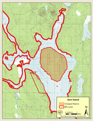
(Download a Printer Friendly Version-522 KB pdf-of this map.)
Exemplary Natural Communities
| Scientific Name | Common Name | State Rank | Global Rank |
|---|---|---|---|
| Spruce - Fir - Broom-moss Forest | Lower Elevation Spruce-Fir Forest | S4 | GNR |
| White Pine - Mixed Conifer Forest | White Pine Forest | S4 | G5 |
Rare Plants
| Scientific Name | Common Name | State Rank | Global Rank | State Status |
|---|---|---|---|---|
| Juncus subtilis | Slender Rush | S1 | G4 | T |
Rare Animals
There are no documented occurrences of rare animals within this Ecoreserve. For more information on rare animals in Maine, visit the Maine Department of Inland Fisheries and Wildlife.
Description
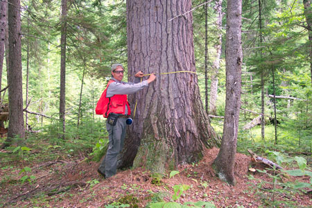
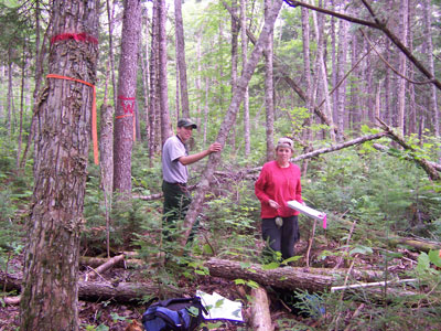
Gero Island is a 3,175 acre island in Chesuncook Lake. Nearly the entire island was classified as regulated timberland, and only 3% is wetland. Most of the island's timber was harvested in the 1920s, and the southeast side of the island was cut again following a spruce-budworm outbreak in the 1980s. In fact, budworm has had a profound impact on the island's forest, creating a multi-aged structure within mixed wood stands. Stands with an abundance of fir were preferentially damaged by budworm; consequently, more uniform stands of black spruce/red spruce and white pine/red spruce emerged with less damage. Two such stands have been identified as exemplary natural communities: one a spruce-fir flat on poorly drained soils in the south-central portion of the island, and the other a mixed white pine/red spruce stand in the northeastern part of the island. This latter stand supports white pine trees with an average diameter of 38 inches.
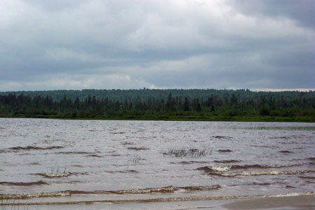
The lakeshore habitat is influenced by the dramatic dam-influenced drawdown of Chesuncook Lake. Four campsites occur along the shoreline.
Resources
- Gero Island Land Management Plan. 1980. Bureau of Public Lands, Maine Department of Conservation, Augusta, Maine. 31 pp.