DACF Home → Bureaus & Programs → Maine Geological Survey → Hazards → Earthquakes → Recent Maine Earthquakes → 10-16-12 Earthquake
Waterboro Earthquake October 16, 2012
The New England Seismic Network and the U.S. Geological Survey report that an earthquake occurred at 7:12 pm (EDT), Tuesday evening, October 16, 2012, in northern York County, with an epicenter near the Waterboro-Hollis town line.
The following parameters have been calculated for the earthquake:
| Magnitude | 4.5 (Nuttli magnitude) or 4.0 (moment magnitude) |
| Location | 43.60 degrees North latitude, 70.65 degrees West longitude |
| Depth | 3.6 kilometers |
| This places the epicenter about two miles northeast of East Waterboro and three miles west of Hollis Center, Maine. | |
Note that early calculations, some of which were reported in the news media, gave the higher Nuttli magnitude or body magnitude. The U. S. Geological Survey prefers the moment magnitude.
Felt Reports
The earthquake was widely felt across central and southern New England from Bangor, Maine to Hartford, Connecticut, with scattered reports as far as northern New Jersey and central New York State. By Wednesday morning, over 16,000 reports had been submitted to the U.S. Geological Survey's online site. The regional intensity map shows a small area near the epicenter with peak intensity V, and most of the felt area reporting intensities II to III.
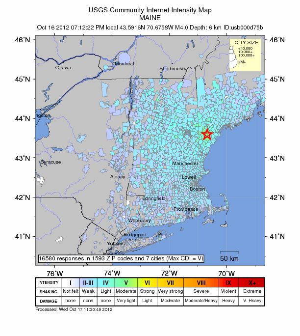
October 16, 2012 - The regional intensity map shows a small area near the epicenter with peak intensity V, and most of the felt area reporting intensities II to III.
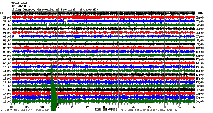
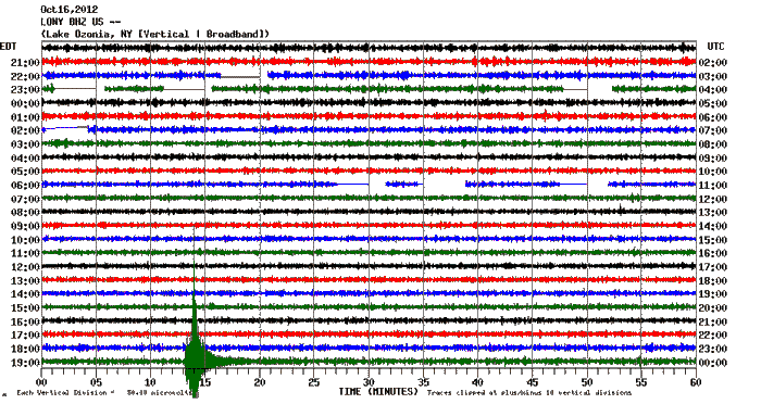
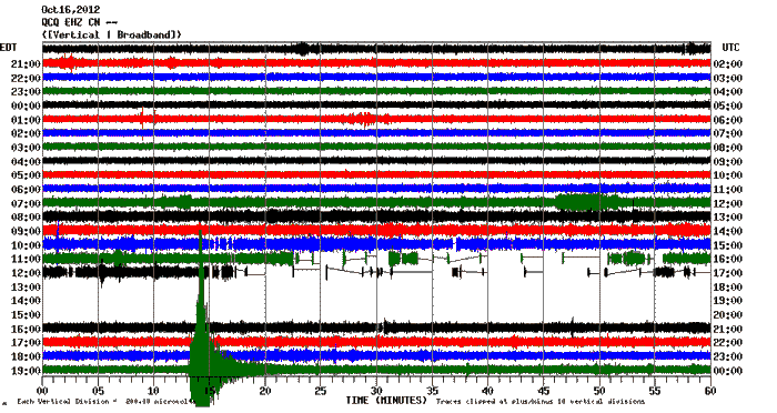
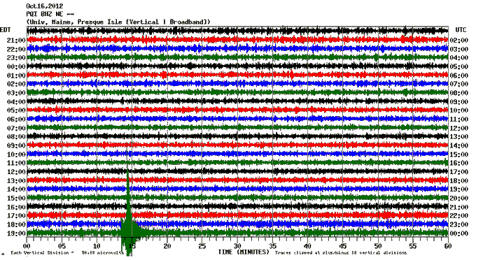
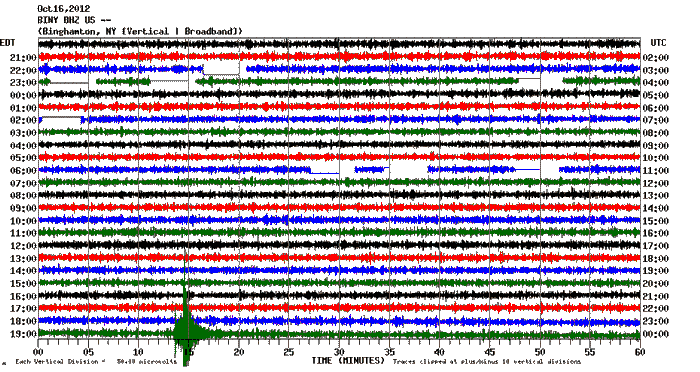
Seismic Recordings
Automatic data recorders across the region recorded the earthquake. Here are some of the plots from the region, in order from closest to the epicenter to farthest.
- Waterville, Maine (station WVL)
- Dover-Foxcroft, Maine (station PKME)
- Lake Ozonia, New York (station LONY)
- Quebec City (station QCQ)
- Presque Isle, Maine (station PQI)
- Binghamton, New York (station BINY)
Last updated on December 6, 2012