DACF Home → Bureaus & Programs → Maine Geological Survey → Explore Maine Geology → Maine's Surficial Geology → Introduction to Surficial Materials
Introduction to Surficial Materials
Geologic processes such as weathering and erosion break bedrock down into smaller particles of sediment. Sediments such as clay, silt, sand, gravel, and other loose deposits which lie on top of bedrock are grouped together in the general category of surficial materials. These materials are not soils; they are the deeper earth materials that lie between the soil zone and the underlying bedrock. Soils commonly develop by weathering of the uppermost part of these materials.
Mapping Surficial Materials
When mapping the surficial geology or the extent of sand and gravel aquifers in a quadrangle, a geologist first makes observations about the surficial materials at a network of points throughout the area. These points of observation may be auger holes, road cuts, gravel pits, stream cuts, or other places where sediments are visible. The geologist describes the materials at each location using size abbreviations as detailed in the surficial materials map explanation (PDF format). Sedimentary materials range in particle size from clay (<0.002 mm) to boulders (>256 mm or 10in). The observation points are plotted on the quadrangle and the resulting surficial materials map shows what is known about the distribution, thickness, and texture of sediments in the area.
By combining materials data with well and test hole data, seismic studies, other published information, and analysis of aerial photographs, the geologist then interprets the pattern of these materials to create a geologic map.
Uses of Materials Maps
The data shown on surficial materials maps may be used for a variety of purposes by landowners, planners, teachers, or anyone else wanting to know what lies beneath the land surface. For example, it may aid in the search for economically important deposits such as sand and gravel for aggregate or clay for bricks or pottery. Environmental issues such as the location of a suitable landfill site or the possible spread of contaminants are directly related to surficial materials information. Construction projects such as locating new roads, excavating foundations and utility lines, or siting new homes are also important uses of materials data.
Surficial materials maps are often best used in conjunction with related maps such as surficial geology maps or significant sand and gravel aquifer maps. Refer to the list of related webpages below.
Photographs
The photos below are examples of the various material sizes as they are observed in the field. Note especially the photos at the bottom of the page. These photos show interbedded layers of materials as they may often be seen in the field. Materials in a gravel pit are rarely all a single size, and these examples show their possible complexity.
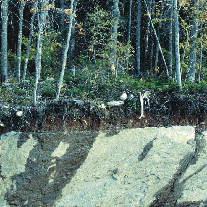
Figure 1. Till over bedrock: Road cut on Route 17 in Township D, showing thin layer of till overlying glacially eroded bedrock. Dark streaks on the rock face are wet areas.

Figure 2. Till: Borrow pit near Millinocket, exposing sandy, bouldery till. This stony till commonly occurs in areas of granitic bedrock.
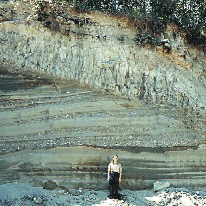
Figure 3. Clayey silt over sand with pebble-cobble gravel: Borrow pit in Kennebec River valley, Pittston, showing glaciomarine seafloor mud (Presumpscot Formation) overlying sand and gravel deposited in submarine fan at glacier margin.
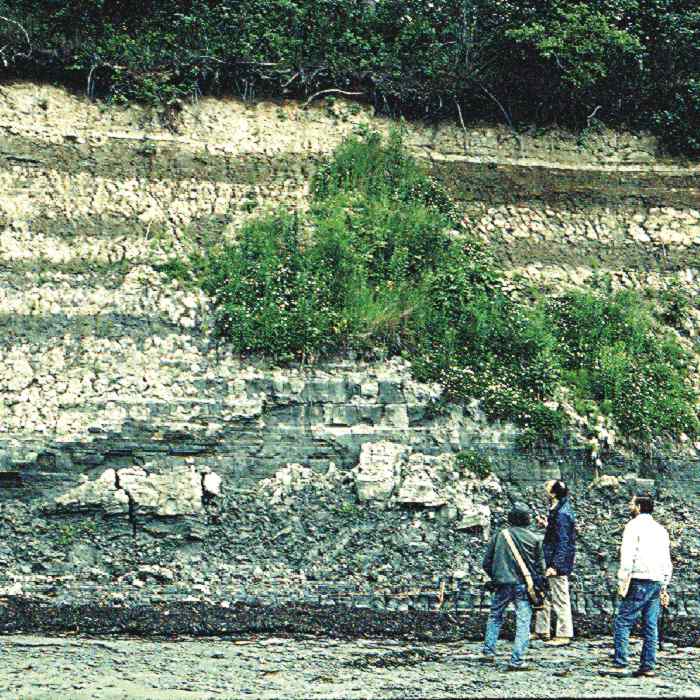
Figure 4. Clay-silt: Coastal bluff in Brunswick, exposing a thick section of well-stratified glaciomarine seafloor mud (Presumpscot Formation).
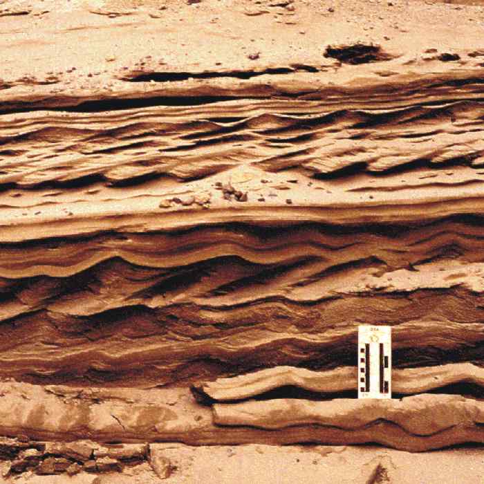
Figure 5. Sand: Close-up of pit face in glaciomarine delta west of Dolby Pond, Millinocket, showing current ripples in sandy delta foreset beds. Scale card is graduated in centimeters and inches.
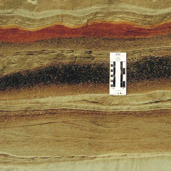
Figure 6. Sand (ranging from very fine-grained to very coarse): Close-up of pit face in well-stratified sand beds deposited in glacial lake at lower end of Bear River valley, Newry.
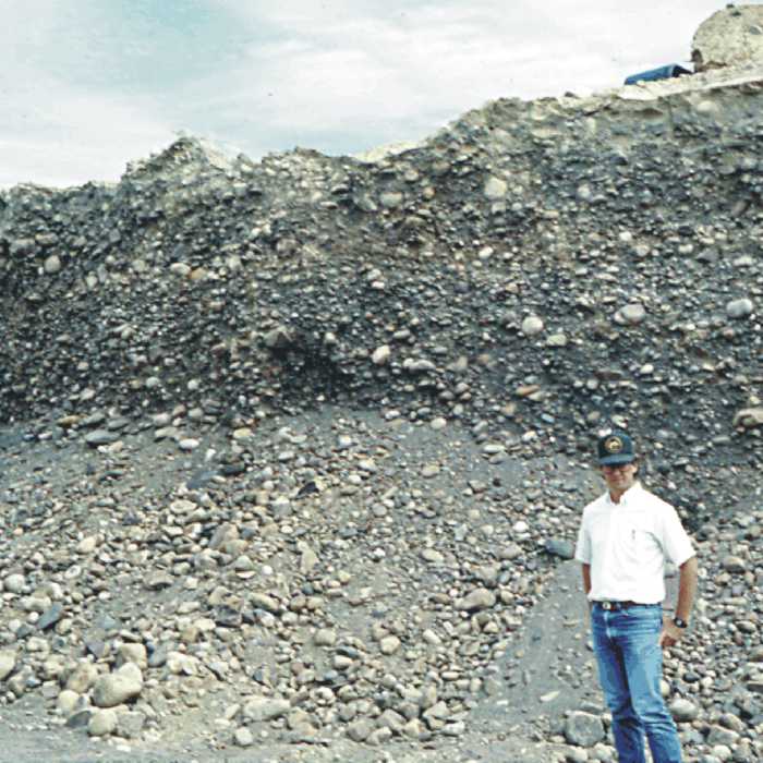
Figure 7. Pebble to cobble gravel: Pit in upper part of glaciomarine delta in Norridgewock, Kennebec River valley, showing massive gravel deposited by meltwater streams flowing across delta top.
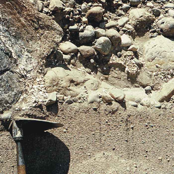
Figure 8. Pebble to boulder gravel (fossiliferous) over gravelly sand: Close-up of pit face in marine nearshore deposit with fossil shells and barnacle-encrusted stones.
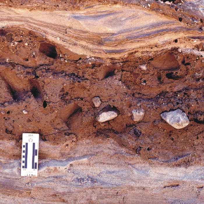
Figure 9. Sand with interbedded flowtill: Close-up of pit face in an end-moraine, Westbrook, showing part of a stony flowtill lens (center) deposited where glacier margin terminated in the sea.
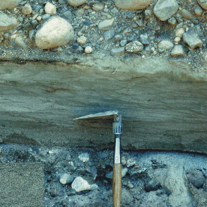
Figure 10. Gravel over sand over gravel: Close-up of pit face showing intertidal(?) sand unit between pebble-cobble gravel beds in upper part of glaciomarine delta, Columbia Falls.
Related Links
Originally published as the sidebar for the Maine Geological Survey's Surficial Materials series.
Last updated on April 23, 2012